Running
36 km
36 km
2,288m
Running
36 km
36 km
2,288m
Running
5 km
5 km
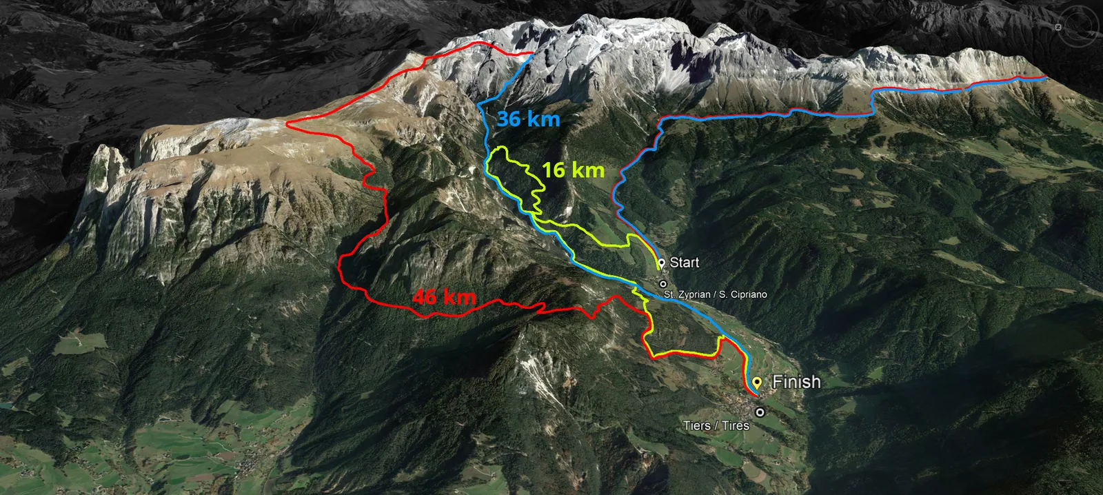
A high-altitude Sky Marathon and Sky Trail set in the Dolomites, climbing from Tiers/Tesido to the Schlern summit and back, with 46 km, 36 km and 16 km options featuring around 3,000 m of elevation gain.
Aid stations on course (food & drink) — details on website / Zuflufstellen an der Strecke (Verpflegung durch Seiten der Veranstaltung)
Pacemakers will be provided for main groups; refer to Renntag start order / Startzeiten and Pacerflaggen on the event website for wave-specific targets.
Monthly averages based on historical data (2000–present).
Last updated: Jun 5, 2026, 11:55:37 PM
We'll email you when races match your filters. No spam — only what fits your goals.
On your marks
Loading race details…