Running
Total with optional checkpoints (~15 miles)
24.1 km

Running
Total with optional checkpoints (~15 miles)
24.1 km
Running
Extended with optional checkpoints (~15 miles equivalent total)
24.1 km
Start: Nov 9, 07:00 AM
Running
Core route
21.1 km
Start: Nov 9, 07:00 AM
Running
Core route (13.1 miles)
21.1 km
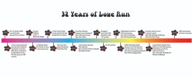
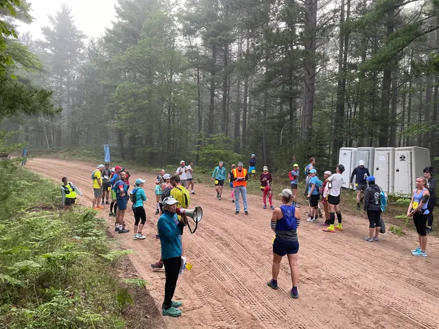
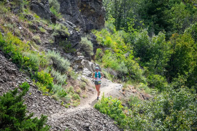
Kentucky’s longest-running adventure race returns for its 24th running as a classic, off-road navigation challenge. Expect a big, strategic course built to reward smart decisions with foot, bike, and boat segments across the Red River Gorge area. Options for a 12-hour cutoff or a 24-hour endurance format.
On-course Verpflegung / aid station: Water, electrolytes, homemade calories and snacks at the halfway aid station; post-race meal provided.
Pacemaker/Pacer: No competitive pacers; the event is non-competitive with a 12-hour (possibly 24-hour) cutoff. Rest and strategy are encouraged; staff will be at put-in and takeout to support participants.
Monthly averages based on historical data (2000–present).
Register on the official organiser website.
Sign up nowLast updated: Jun 6, 2026, 12:08:22 AM
We'll email you when races match your filters. No spam — only what fits your goals.
On your marks
Loading race details…