Laufen
Full Course
380 km
Laufen
Full Course
380 km
Trail
Full Dragon
380 km
Start: 5. Sept., 11:00
235,00 EUR
Trail
Hatchling
190 km
Start: 11:00
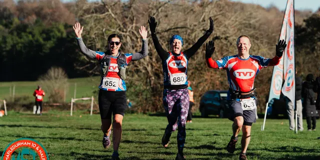
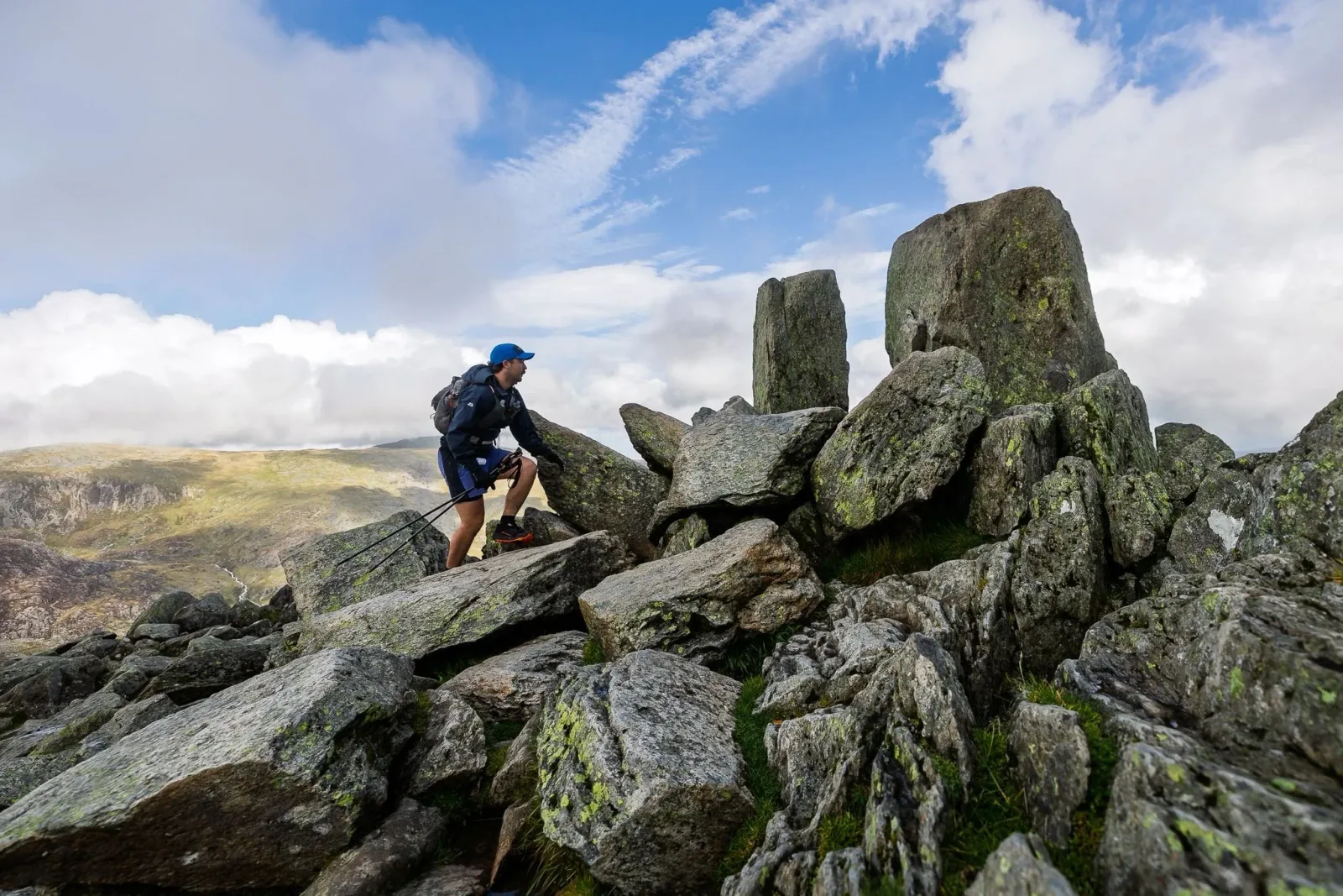
One of the world’s toughest mountain ultra races, a 380km, 6‑day journey through the mountains of Wales with around 16,400m of ascent along the iconic Dragon’s Back route.
Evening meals daily (days 1–6) provided at the camp; includes options such as vegetarian, vegan, and gluten‑free. Detailed menu at info/catering.
Pacemaker/Pacer: time guidance per start wave published on the Renntag für Laufende schedule; Pacerflaggen displayed on course. Expect 2–6 sentences of on‑course pacing and support guidance.
Monatsdurchschnitte aus historischen Daten (2000–heute).
Please join the Dragon’s Back Race® participant Facebook Group.
Participants will need to book their own accommodation on the night before the race start. This is not included in the price of the event. We recommend using AirBnB, Booking.com or Visit Wales to aid your search.
There isn’t dedicated event parking in Conwy. Participants wishing to park a car for the week in Conwy can do so at Morfa Bach Car Park near the registration venue - LL32 8FZ. This car park may be subject to charges.
There isn’t dedicated event parking in Cardiff. Sophia Gardens Car Park in Cardiff city centre would be a good option for parking - a week pass is £80.00 at the time of writing. We would also recommend checking the Cardiff Council website for parking solutions, or taking public transport. Remember that we are still providing a bus service from here to the start in Conwy (see below).
We will be in touch to ask you to edit your entry with this information at the appropriate time - check here. The options will be: a) Book a space for the coach that will depart from Cardiff (near finish venue) on Sunday 12th September to transport me back to Conwy. b) Book a space for the coach that will depart from Cardiff (from the main entrance to Cardiff Castle) on Sunday 5th September to transport me to the registration venue in Conwy. c) no coach required thanks - I’m making my own transport arrangements.
A limited baggage transfer service (max. weight 23kg and max. size 56x40x23cm) from Conwy to Cardiff will be available strictly to those travelling to the event via public transport (geared at those needing to go straight on to an airport or train station after the event), charged at £30 to cover extra van hire and drivers. This is an optional extra and we will let you know when it is available to book pre-event.
Please read this article - Guidance on your options if you can no longer attend. Have you seen our new Pregnancy Deferral policy?
It is a tough challenge but with the right preparation, anyone can complete the event if they are willing to put in the time to train and prepare well. This training will likely involve gradually building up your mileage and running back-to-back days in the mountains to get used to rough terrain. Given that Wales is fairly accessible from many parts of the country, lots of participants visit in advance to explore the route. This can be very helpful to familiarise yourself with the route and the terrain ahead of the event so that you know what to expect. Take a look at our guidance articles - How to train for 6 days of mountain running and Guidance on exploring the race route pre-event for more advice.
Yes! The Dragon’s Back Race® is held annually. Our sister event, the Cape Wrath Ultra® is also held annually. If you don’t feel ready for the full race route, you may also prefer to try the Hatchling. This allows participants to experience the race route in more manageable chunks. It is still an epic mountain challenge, and your achievement will be recognised with a special memento at the finish.
The route is not marked on the ground - so you will be required to navigate using a GPS device and/or map and compass. This event has been designed so that it is possible to complete it by following the GPS track. However, even if you are navigating using a GPS device, it is mandatory to carry at all times the Harvey Maps 1:40 000 scale event map that we will supply at registration. Many participants find that using a combination of both the event map and a GPS device works well for them. It will be more difficult to follow the route in poor weather or low visibility, especially on the sections of indistinct ground in the mountains. We may ‘tape’ certain tricky sections (always close to the overnight camps). You will likely find yourself travelling along with others which will help but should not be relied upon. Overall, we would suggest map reading skills practise should be included in your training for the event. Read our guidance article on following the route for more information.
Yes, if you are a practised map user. The event map has been optimised for this terrain and the Dragon’s Back Race® route. If you are navigating with a GPS device, then the paper map is an item of mandatory kit and must still be carried. The paper map has supplementary information such as what to do in an emergency and information about the flora and fauna in the area.
As a rule of thumb, no. The only exception to this is on rare occasions on specific (and short) sections of ‘mandatory route’.
The route will be shown by two different coloured lines on the map, indicating whether the route is mandatory (orange line) or recommended (yellow line). Find out more about the mandatory and recommended routes in our guidance article on following the route.
In truth, maybe, but we require every individual to be self-sufficient as stated in the participant declaration* which all participants must agree to when entering the event. We ask for self-sufficiency because if an inexperienced person became separated and lost, and in bad weather, then that person is much more vulnerable to an escalation of hazards and their personal safety. Some people enter the event with friends or relatives, but you should not assume that you will be able to complete all days of the event together (in our experience it is very unlikely that you will be so equally matched over such a long event). We also expect you to make some great friends at this event who you will undoubtedly spend some time on the route with, but please respect those who wish to enjoy a more independent challenge. *The participant declaration includes the statement ‘I am an experienced off-road runner’ which implies that you will have a certain capacity to resolve navigational challenges and you have declared that you are experienced enough to have a reasonable chance of completing this event - with consideration to its unique nature.
Yes, altimeters can provide useful and accurate information, especially as some GPS devices will occasionally struggle to provide accurate height data in steep-sided terrain. Many modern watches and devices have altimeter functions, but be aware that altitudes derived from barometric pressure are likely to be more accurate than those from GPS. Make sure you are familiar with the operation of your altimeter before the event as you may need to calibrate it accurately.
It is important to note that the digital route data (via ViewRanger or released GPX files) provided shows less distance and varying height gains to the information on The Route page. There are many reasons for this, some technical, but principally because it is not possible to draw every micro-wiggle that a participant will take when actually following a track on the ground. The terrain is often rough and with many micro twists and turns, bumps and dips. GPS repeatedly, though only momentarily, struggles in these terrain types. This generally has the effect of flattening and shortening the terrain. Conversely, with online measurement, the package height data can cause an over-estimation of ascent. The bottom line: the summary information not provided by digital route data is the better estimate of the actual distance and height gain that participants will do. External article: How accurate is your GPS watch? How accurate are the distances and height gains? Finally, it is worth noting that these distances and height gains are based on the optimal route choice learnt from significant experience on the ground and considerable time spent planning and testing various route options; it is easy to run further, and many participants do.
Open Tracking provides the timing for the race. Participants’ GPS trackers are also used to record times.
The GPS trackers transmit a signal which can be used to track participants’ positions along the course, and geo-fencing can be used at checkpoints to record times. Additionally, when participants pass gantries at the start, support points, and finish, times are recorded. At each checkpoint along the route, there will be an orange and white flag containing a transmitter, and as participants pass (close) by, then times are recorded and transmitted by this device.
We will be able to use the system to see whether participants have been to every checkpoint. We know that honest mistakes happen, and we don’t want to penalise participants for a momentary lapse of concentration… However, we also don’t want to disadvantage participants who have taken the time to ensure that they visit each checkpoint. Therefore, the Senior Event Team, usually the Race Director, will assess each case on an individual basis. See the Universal Event Rules for more information.
Sometimes trackers don’t work for a variety of reasons, but this is usually picked up very quickly and the team will replace it as soon as practical.
Your tracker is part of your mandatory kit, so it should be with you at all times on the course. If you leave it anywhere you are breaking one of the rules in place for your safety. Your mandatory kit must be with you at ALL times.
A GPS device to navigate with is not essential or mandatory, but it is recommended to aid your navigation whether this is a handheld (dedicated GPS unit or smartphone) or wrist-worn device.
No. The paper event map you will receive at registration is produced by Harvey Maps and uses their 1:40,000 mapping, so we recommend sourcing digital maps by Harvey Maps. Ordnance Survey maps are also commonly available, and it might be useful to have a variety of map options.
Yes. Six GPX files of the provisional route are already available on The Route pages (one for each day of the event). These files will be updated before each event and the final version sent to participants a few weeks prior to the event.
Sorry, we can’t offer one-to-one technical support. Any problems are often answered quickly in the participant Facebook Group. It is important that if you intend to rely on a GPS device, that you are familiar with accessing GPX files on it and then using them to navigate effectively.
This (external) article should help.
No, this device is primarily for both race control and online viewers to see your location and follow your progress throughout the event. It does not have an interface that you can use to navigate with, but it does allow you to summon help in an emergency. Race control will also be able to use it to prove your route choices should there be any need for scrutiny.
Yes, you must carry it on the course each day, and we might take it back off you for overnight charging once or twice during the week when you arrive at an overnight camp, then reissue it to you in the morning just before you cross the day’s start line.
The GPS tracker will be attached by us to your rucksack at registration (and any other time during the event) to ensure optimum positioning.It must never be wrapped inside anything metallic, i.e. ‘foil’ survival bags or a metal lunch box.If taking shelter in a building, you must leave the GPS tracker outside with a clear view of the sky.
Road trainers are not acceptable. We don't recommend waterproof shoes (as these will tend to hold water) - it is better to have shoes that can release water more easily through their upper fabrics. We recommend considering carefully your sock choices, including perhaps breathable waterproof socks. You have a broad choice of footwear types; anything from deeply studded mountain shoes to general trail shoes. Grip will be essential on slippery varied terrain (such as grass, peat, mud, rock, gravel, river crossings) and steep descents, and the sole rubber selection can affect grip on wet rocky paths or bedrock. There are also long sections of hard surfaces (asphalt / tarmac) along the route, and some participants might choose to use different shoes for different sections. You should have tested your shoes before the event in similar terrain, but they should not be overly used as they will hopefully have to last 380km! The shoes should be correctly fitted. You will be able to take spare shoes in your overnight or resupply dry bags. It is possible that you might ‘destroy’ a pair of shoes (or the tread might get worn down) during the course of the event, and that a second pair (same or similar model), might be advisable.
Yes. Whether you should be using walking poles is a more difficult question to answer and depends largely on your experience and ability. There will be some ascents and descents of such gradient that poles will be a relevant choice. The poles should be collapsible so that they fit in your dry bag should you not be using them.
Please refer to the kit requirements in the essential info section of the website. If the forecast is particularly poor additional mandatory items may be added and this will be communicated to all participants each evening. Conversely, we may relax on certain items if we see some assured good weather ahead. This is unlikely, but possible (the days are long, and the weather is notoriously changeable), though you must come to the event with all mandatory gear to hand - any excess clothing and equipment is packed into your overnight dry bag.
Having the right kit can be essential for participants' safety during the event. We have also made certain undertakings on behalf of the participants to landowners and authorities about what safety kit participants will be carrying. Therefore, each day there will be random kit checks for ALL participants. Participants found to be missing mandatory items will receive a 'strike', participants suspected of cheating may be disqualified. If you have any questions about the acceptability of your kit, please do not hesitate to contact us. See the event rules for further information.
No. You must have a survival bag. This item can be purchased in our shop.
Yes - in good time ahead of the event we will be in touch with all participants in order to ask them for their tent sharing preferences. We will always do our best to accommodate specific wishes.
We always try to accommodate friends and groups together in the same tent. For safety reasons, participants must stay in their specified tent during the event week. We will contact participants regarding tent allocation requests a few months before the event. The details of the final tent allocations will be available at race registration.
Accommodation provision is from day one (i.e. upon arrival at the first overnight camp) through to day six. For the avoidance of doubt, participants are responsible for sourcing their own accommodation in or near Conwy after registration and before the day one start and in Cardiff on the last day.
In summary, you should not be expecting to shower after every day of running but there will some opportunity to make use of the nearest river/stream for washing in, which at least is refreshing! Here is a basic summary of what you can expect: After day 1 = RiverAfter day 2 = A small number of showers and a riverAfter day 3 = StreamAfter day 4 = RiverAfter day 5 = StreamAfter day 6 = Showers in Cardiff (available to purchase, we will advise on these before the event)
Day One - There is a mass start for all participants at 06:00. Note that participants time will start when leaving Conwy, not at the Castle itself. Days Two to Five - Participants will be allocated a start window (for example between 07:00-07:30) based on their finishing time from the previous day; the slowest participants start first and fastest participants last. It is crucially important that participants start within the recommended time window or there is a significant likelihood that they will fail to meet the checkpoint cut-off times later in the day, or needlessly queue for breakfast with other runners in an earlier start window. Day Six - If there is less than one hour between the leading participants, there will be a Chasing Start with the leading individual starting at 08:00. The Chasing Start will continue for one hour. Otherwise, the start procedure will be as above. Details of the Chasing Start will be announced on the evening of the fifth day. See the Chasing Start from Day 5 of the 2017 Dragon's Back Race®. We reserve the right to mandate specific start times for any/all runners each day.
There is a charging tent where you will be able to charge your devices. Devices are left at the participant’s own risk.
There will be at least 2 manned checkpoints each day. At all manned checkpoints: there is an enforced cut-off time (see guidance article on checkpoints & cut-offs)it is possible to retire (see guidance on retirements and the reduced course)we will provide emergency help and it will be possible to summon a medic to these locations based on the medical teams’ priorities and your immediate needs. At one manned checkpoint each day, participants will be able to access their resupply dry bag. This is known as the support point and is approximately mid-way each day. At the support point, a small team will be there to greet you, and water will be available for you to refill your bottles. We aim to be able to provide water at at least one other location along the route each day, especially during warm weather.
No, it is against the event rules for any participant to receive outside support, such as friends/family providing assistance or food, and contravening these rules will result in severe penalties. It is perfectly acceptable for friends and family to intercept participants on the course to cheer them on. Friends and family are welcome at Conwy Castle for the start, but not inside the registration or briefing marquees. They are also very welcome at Cardiff Castle for the finish and the presentation evening. Please familiarise yourself with the event rules.
The route will pass through a number of towns and villages and close to some shops, and if participants want to buy supplies from shops they are allowed to - but we cannot guarantee anything will be open when you pass by. This is especially the case on day three where the route passes through the small town of Machynlleth which has several supermarkets. Many participants find that stopping here to buy some extra supplies is time well spent – if time allows!
Water will be provided at the overnight camps and support points. This will always be mains water suitable for drinking.
Not necessarily. You will be able to take water from streams and rivers as you progress along the route each day. You should avoid taking water from around livestock or human settlements. Note that there will be some long sections with fewer streams, and you will need to plan appropriately. Drinking water is provided at the daily support point, and at one other location each day.
Each manned checkpoint is accessible via a vehicle and at these locations, it is possible for participants to retire into the immediate care of our event team. Read our guidance article on retirements & continuing non-competitively for further information (for example retiring elsewhere on the course). If you find you are unable to complete the full course, you also have the option to swap to the Hatchling.
There will be a well-equipped medical team for participants at each overnight camp and support point and a medic may be directed to manned checkpoints if required. However, in general, participants will be expected to look after themselves and must bring a personal first aid kit (see kit requirements in the essential info section) for the self-treatment of most issues. The medical team will prioritise serious incidents and ailments, but will advise on minor issues. Participants are encouraged to talk to the medical team if they have any concerns about their personal well-being. Please read the medical guidance and footcare guidance for further information.
We usually offer the service of Dragon Mail™ which allows friends & family to send messages of support to specific runners during the week. These messages will be distributed by the event team at the overnight camps. Details on how to use Dragon Mail™ will be shared with active participants just before the event. Friends & family should also follow race coverage on Facebook & Instagram, as well as tuning into the Dragon’s Back Race show and reading the news stories on the website!
Please read the catering section on the essential info page. All meals at the overnight camps are based on a meat and fish FREE menu with the option of adding diary - cheese and eggs - to make them vegetarian. All the meals are high in calories and nutritionally complete to provide the right balance of micro and macro nutrients for participants undertaking a very tough physical challenge. Why a meat and fish free menu? Read our sustainability policy here.
Tea, coffee, hot chocolate, water, squash and hot water will be available whenever the kitchen is open (i.e. most of the time).
Whilst there will be plenty of food, it is important to note that any one type of food is literally not unlimited, and the catering tent is only open at specific times. We serve standard portions of meals and ask that hungry participants come back to the catering tent for a second helping. This policy reduces food waste enormously and helps to ensure that everyone at the event is well fed each day.
Participants must supply sufficient quantities of their own food for eating out on the course - between overnight camps - each day. It is clearly important that participants do not underestimate how much food they require. The route will pass occasionally via food outlets/shops. Note that it is prohibited for participants to take food from the catering tent to supplement their hill food and this will be checked as part of random kit checks each day.
Sauces such as tabasco, ketchup, brown sauce etc. will be available.
These are announced once the final menu is released to the participants.
For participants that have a diagnosed food allergy that is evidenced by a letter from their doctor, we are able to provide an additional baggage allowance (6kg for the Dragon’s Back Race®) so that they can carry additional food and cooking equipment only. In all cases, we are unable to transport food that requires refrigeration or freezing, and this additional food/equipment will be transported with the general overnight dry bags. Our kitchen is unable to prepare any special meals, and participants with their own food will need to prepare this in main marquee (no food preparation/cooking is allowed in the blue tents). The realities of preparing meals for hundreds of participants in a basic kitchen in an expedition race setting means that we are unable to guarantee the separation of food allergens (for example diary, nuts, etc.) when the meals are prepared and served. We are able to provide gluten free meals. We will of course do everything reasonably practicable to accommodate the requirements of the participants within the boundaries of the menu being offered. Sorry, we are unable to give special dispensation for participants with personal dietary preferences that fall outside our menu.
Please read The Route pages for detailed information about the nature of the route each day. Please do not underestimate the cumulative difficulty of wild, remote and totally trackless ground. It is very rough underfoot. In 2012, one seasoned 100-mile ultra-runner stated that any day of the Dragon's Back Race® was tougher than any of the 100 milers he'd done... and he's done over 100 of them!
You are welcome to explore the route before the event – check out the guidance article on exploring the race route pre-event. In fact, if you are exploring, please update us on your findings. With every winter there can be changes such as flooding, wind damage and erosion. We are particularly interested in any information regarding remote bridges and path conditions. Be aware that is it is not possible to explore the entire route – there are small sections which are private and should not be accessed except during the race (when we have arranged access). Full details of these sections are in the Guidance article (mentioned above).
Yes! The Dragon’s Back Race® is pleased to be partnered with RAW Adventures - an established Snowdonia based mountain activities operator, with excellent knowledge of the event and race route. RAW Adventures provide the official race recce trips on behalf of the event - more details can be found on their website. These recce trips provide an excellent opportunity for participants to get to know the race route pre-event - with the guidance of an expert mountain leader who knows the terrain and can provide first-hand insights into the race experience.
On most days, we expect that the fastest participants will be out for on average 8-9 hours, and the slowest participants will be out for approximately 13-15 hours. Please have a look at the results to gauge how long the participants were out for on past events.
On all days, the Course closure time is 22:00. On day one there will be a mass start from Conwy castle at 06:00, while the earliest possible starting time on all other days is 06:00. Have a look at the Key timings section in the essential info for more details.
Reasonably - this is what you are here for! During much of the event you will have limited phone signal and be many kilometres away from the nearest civilisation. If you are concerned about being alone out there - make some friends and travel together!
Upon entering the Dragon’s Back Race, you can choose either the Hatchling course or the full race route. The Hatchling course offers the opportunity to do part of the full race route each day. This option is a great stepping stone to completing the full race route in the future, but also a brilliant experience in its own right. Also, participants who fail to complete one or more days of the full race route (i.e. arrive at a checkpoint after the cut-off time, arrive at the finish after the course closure time, or decide to withdraw from that day's course) will be allowed to continue in the event by swapping to the Hatchling.
You should be ready for a whole range of weather conditions in the Welsh mountains during the month of September, from sunny skies to rain clouds and everything in-between. Peak daytime temperatures could reach 25°C (77°F). However, it is also likely that participants will experience low cloud, rain, wind and temperatures closer to 5°C (41°F) during some days. With wind-chill and rain, these are potentially very dangerous conditions. Weather conditions on the mountain summits are often much more extreme than at lower altitudes. Participants should be prepared for spending extended periods of time at higher altitudes. As with all mountain environments the weather can change quickly and we expect participants to wear/carry the appropriate clothing (please see kit requirements in the essential info section) each day, some of which will be mandatory. A weather forecast will be posted at the overnight camp each evening and morning.
Precautions are essential. It is also possible to become dehydrated and, even more seriously, suffer heat injuries. Read our Medical guidance article for advice on this.
At times, yes, very likely, so good clothing equipment choices are essential. Please read the kit requirements in the essential info.
Probably if you are not one of the faster runners - Sunrise will be at approximately 06:30 and sunset at approximately 20:00 during the event, with complete darkness by 21:00. You will be carrying a headlamp as this is mandatory equipment while running (please see kit requirements in the essential info).
Maybe. Midge conditions vary each year according to the weather and should not be a problem during the day. A midge net is part of the mandatory camp clothing and equipment (please see kit requirements in the essential info). Note that mosquito nets are not sufficient as midges are much smaller. We recommend that you keep your tent doors and zips closed.
Ticks can carry a nasty infection called Lyme Disease, and although it is rare in Wales, it is not worth taking any risks. It is important to find and remove ticks every day. You should bring a tick removal tool and know how to use it. Long clothing will help stop ticks attaching themselves to you. You may wish to find a friend to help you check! See our medical guidance article for more info.
There is a very, very low risk of dangerous encounters with animals. Adders (snakes) are venomous, and the consequences of a bite can be fatal if untreated rapidly. Encounters are extremely rare. In very extreme circumstances cows (bulls) can charge at you (especially if they feel threatened in some way). Keep your distance and there shouldn't be any problems.
This will be limited, along with 3G/4G coverage.
Sorry, no. Race control will maintain a satellite internet connection for safety monitoring, but access will be strictly limited to relevant event personnel only.
For Elite Runners, to gain a free race entry to one of the Ourea Events races, this is determined by either their overall UTMB Index or their ITRA Performance Index. You must demonstrate that you have a valid and current score in either index. Elite entries are limited per race and will be determined by their demand and availability. UMTB Index (overall) Men 800 Women 650 ITRA Performance Index Men 825 Women 700 Where this quota has been reached, races are sold out, registrations are closed or less than 30 days before the event, free entries will be subject to the event director’s discretion. Please submit a request via the contact form on the race website.
Zuletzt aktualisiert: Jun 6, 2026, 12:30:39 AM
Wir mailen dir, wenn Läufe zu deinen Filtern passen. Kein Spam — nur passende Rennen.
Auf die Plätze
Racedetails werden geladen…